
The Dynamic Earth, Plate Tectonics Map, Laminated, 36" x 24"
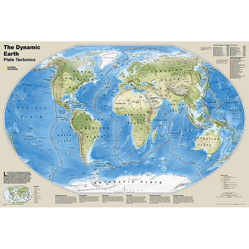
- National Geographic Dynamic Earth, Plate Tectonics Wall Map illustrates plate tectonics and features stunning bathymetry and naturally colored relief, as well as volcano and earthquake data through 2011.
- The Dynamic Earth map illustrates 17 major tectonic plates and highlights diffuse plate boundaries, convergent boundaries, spreading boundaries, fault zones, hot spots, notable earthquakes and volcanic eruptions of the 20th and 21st centuries, earthquakes with a magnitude of greater than 6.5 during the 20th and early 21st centuries, and notable vol
- The interaction of these plates causes earthquakes and volcanoes and shapes the earth's crust into mountains, valleys and deep-sea trenches.
- The map is encapsulated in heavy-duty 1.6 mil laminate which makes the paper much more durable and resistant to the swelling and shrinking caused by changes in humidity.
- Measures 36" x 24"
Description
Specifications
UNSPSC Code
2147483647
Weight
0.25lb
Height
2in
Width
2in
Length
32in
Brand
National Geographic
Category
Maps & Map Skills
Compare