
Antarctica Satellite Map, Laminated, 31.25" x 20.25"
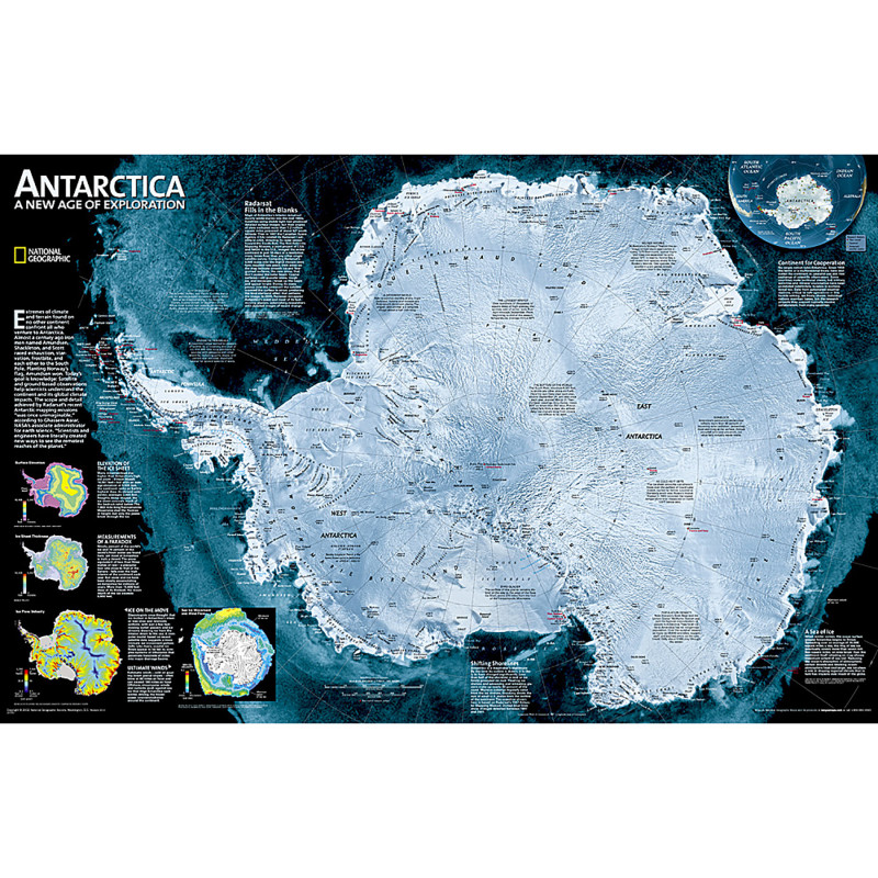
- National Geographic Antarctica Satellite Wall Map has a striking view of Antarctica's terrain, compiled from 4,500 satellite scans
- Additional inset maps show surface elevation, ice sheet thickness, velocity of ice flow, and sea ice movement and windflow.
- The map is encapsulated in heavy-duty 1.6 mil laminate which makes the paper much more durable and resistant to the swelling and shrinking caused by changes in humidity.
- Measures 31.25" x 20.25"
Description
Specifications
UNSPSC Code
2147483647
Weight
0.75lb
Height
2.25in
Width
2.25in
Length
25.25in
Age
14 - 18 years old
Brand
National Geographic
Category
Maps & Map Skills
Color
Multi-Colored
Grade
Grade 9-12
Material
Paper, Plastic
Product Size
31.25 X 20.25 IN
Compare